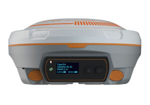


Full-constellation tracking
The T300 Plus tracks 572 channels with all working and planned GNSS constellations including GPS, GLONASS, BeiDou, Galileo and SBAS.
Tilt sensor
The T300 Plus supports up to 30° tilt compensation that allows you collect high accuracy data faster in the field.
Intuitive workflow
The T300 Plus is able to provide easier survey workflow via Survey Master Wizard function, improving productivity for both beginners and professional surveyors.
- GPS L1/L2/L5, BeiDou B1/B2/B3, GLONASS L1/L2, Galileo E1/E5a/E5b
- Advanced QUANTUM Technology
- WIFI/UHF/4G Module
- Tilt Compensation
- Smart Battery Design
- Low Power Consumption
- Support Long Baseline E-RTK
| Signal tracking Channels: | 572 Channels |
| Satellite tracking: | GPS, BeiDou, GLONASS, Galileo and SBAS |
| RTK Horizontal accuracy: | 8mm 1ppm |
| RTK Vertical accuracy: | 15mm 1ppm |
| Post Processing Horizontal accuracy: | 2.5mm 1ppm |
| Post Processing Vertical accuracy: | 5mm 1ppm |
| Initialization time: | less than 10s |
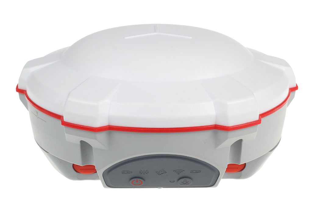
| Size (W × H): | Φ15.8 cm × 7.5 cm |
| Weight (incl. supplied two batteries): | 0.95 kg (2.1 lb) |
| Operating temperature: | -40 °C to 65 °C (40 °F to 149 °F) |
| Shock: | Designed to survive a 2 m drop onto concrete |
| Humidity: | 100% non-condensing |
| Waterproof and dustproof: | IP67 |
| Power consumption (3 constellations): | 3.1 W |
| Memory: | 8 GB |
| 1 Serial port (7 pin Lemo): | Baud rates up to 921,600 bps |
| Correction data I/O: | RTCM 2.X, 3.X, CMR, CMR |
| Position data output rates: | 1 Hz, 2 Hz, 5 Hz, 10 Hz, 20 Hz |
| Modem: | WiFi, 4G, 3G, GSM |
| UHF modem (optional): | Tx/Rx, 410-470 MHz |
| Bluetooth® : | V4.0 protocol |